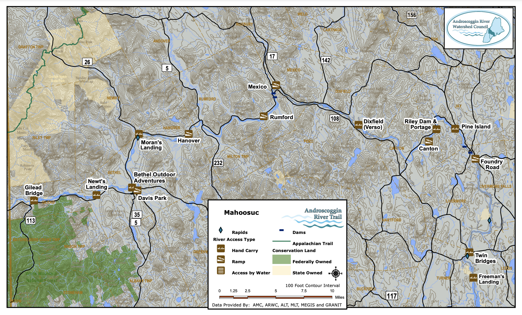
The Mahoosucs
The Mahoosuc section is named for the mountain range just north of the Presidentials in the White Mountains. The range covers much of The North Woods section, but the mountain features that come closest to the river are located near the New Hampshire – Maine border where the valley is relatively narrow. This section continues the remote feel from Shelburne until the paddler reaches the historic village of Bethel (a portion of the village is a National Historic District). The shoreline downstream of Bethel is characterized by woods mixed with extensive stretches of farmland.
There is little development visible from the river and in some areas mountain slopes reach down to a narrow floodplain. The river flows past historic villages in Rumford Point and Rumford Center and reaches a takeout just above the historic paper mill town of Rumford, birthplace of Senator Edmund S. Muskie, the father of the Clean Water Act. A series of falls and dams in Rumford necessitates a significant portage at this time. An overlook provides great viewing of the falls, and Strathglass Park and the downtown island provide a glimpse of the development originally designed to support the Oxford Paper Company. From Mexico through Dixfield and Canton, the shoreline again features dense woods with occasional farms and glimpses of villages. Much of this section offers excellent fishing. A few areas are suitable for motor boats, but drift boat fishing is extremely popular over most of its length.
View and download maps and access site descriptions below.